
Your Guide to Hiking the Franconia Ridge Loop in New Hampshire
Looking at Mount Lafayette from Mount Lincoln on the Franconia Ridge.
The White Mountains are a place that attract millions of visitors annually, especially hikers. Whether someone is from the area or visiting from elsewhere, most will agree that the Franconia Ridge is a special place to be. In fact, National Geographic once named it one of the top hikes in the world. Novice and experienced hikers alike chase the summits of Mount Lafayette and Lincoln regularly, which are both located on this popular ridge and the official 4,000-footer list. The Franconia Ridge is where I first fell in love with the New Hampshire 48, and I’ve heard others say the same. It seems to be the “gateway” mountain, and for good reason.
On November 4, 2023, I was hiking the ridge with a couple of friends. Although it was warmer at the parking lot that day, there was low visibility, snow on the ground, and a light chill in the air on the ridge, meaning winter gear was necessary. Yet, I passed several hikers wearing sneakers and small packs. The Franconia Ridge hike is very well known, but just because it’s popular doesn’t mean it’s easy to accomplish. To help you prepare for this incredible hike, here’s a guide to hiking the Franconia Ridge Loop in New Hampshire.

Mount Lafayette and Franconia Ridge Trail Loop: 8.6 miles, 3,825 feet of elevation gain, rated difficult.
What to Bring on a Franconia Ridge Hike
To hike the Franconia Ridge in dry conditions, you’ll need a good pair of hiking boots, a hiking backpack, both an insulated and windproof jacket, and the ten essentials. If it’s within your budget, I recommend buying a satellite device, such as a Garmin, for emergency situations where you may need a rescue. You should also have rain gear if there’s a chance of it raining that day. Winter adds another layer of risk and experience, which will require much more gear than what’s on this list. In addition, I recommend getting a Hike Safe Card and to always tell someone you trust of your hiking plans.
How to Get to Lafayette Place Campground
Lafayette Place Campground (2 Franconia Notch State Park, Franconia, NH 03580), is located right off of I-93 South and has parking available for hikers. In the summer, the parking lot fills up fast and roadside parking is not allowed. I highly recommend getting there before 7 a.m. to ensure you get a a parking spot.
If you’re coming from the south/heading up I-93 North, you’ll have to turn around and go back down I-93 South. Take exit 34B and turn left onto Tramway Drive to merge back on I-93 South. Then, take the exit for Lafayette Place Campground Trailhead Parking. If you’re coming from the north/heading down I-93 South, then you can just get right off the exit for the campground.
The Best Route For the Franconia Ridge Loop
Hikers have two options for completing the Franconia Ridge Loop: they can either go up Old Bridle Path and down Falling Waters Trail, or vice versa. I have done this hike both ways several times and would recommend that beginners go up Falling Waters Trail and down Old Bridle Path. Some may argue that it’s easier to get Mount Lafayette done first since it’s the tallest peak on the ridge, but when it comes to safety, going up Falling Waters Trail is more ideal.
Going Up Falling Waters Trail
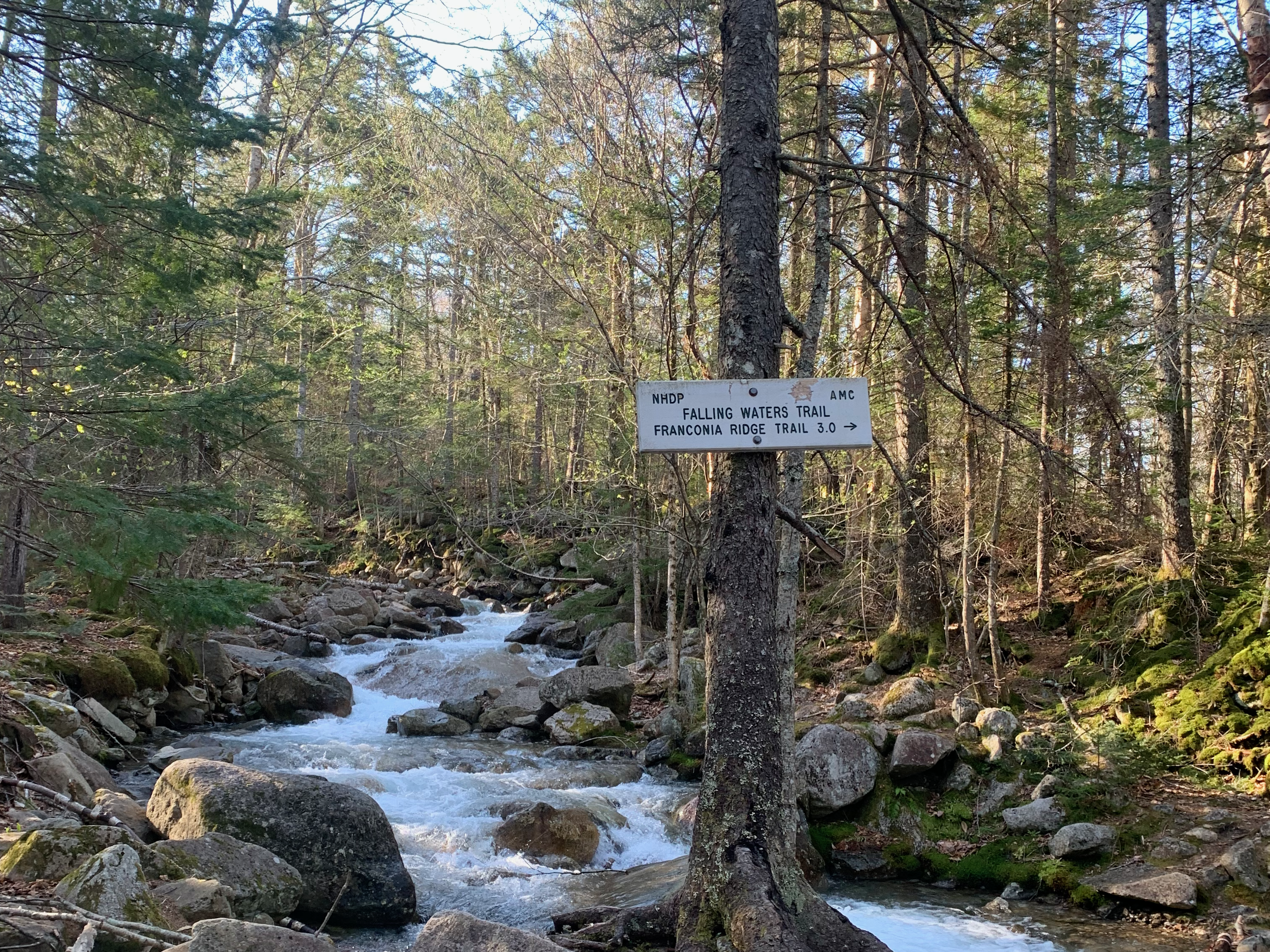
The first junction on the loop, where you’ll continue right for 3 miles to Little Haystack.
Falling Waters Trail has several water crossings and is generally wet, which is why it’s safer to ascend than descend. If it’s the middle of summer and hasn’t rain for days, you’d be fine going down this way; but generally, it’s safer and more common to go up it.
This 3.2-mile trail features a beautiful waterfall and is fairly gradual during the first half. You’ll have a little bit more of a push before getting to the junction at just above 4,000 feet, where you’ll pass by Shining Rock, which is a rock slab that can be seen from the Franconia Notch. To see Shining Rock, turn right at the junction before Little Haystack, but be sure to turn back the way you came in order to get back on trail. There’s water available at Shining Rock if you need it.
A couple of first-time-ridge hikers were in front of us for most of the way on Falling Waters Trail. When we all got to the ridge and started hiking across it, one of them looked at me with a glow on his face and said, “this is amazing.” It made me smile because I remember having that same feeling the first time I walked across the ridge. It feels like a walkway to heaven up there.

A Waterfall for the Wanderlust
A picture-worthy spot on Falling Waters Trail. Take a minute to stop here and admire this stunning waterfall.
Hiking Across Franconia Ridge Trail: Little Haystack, Mount Lincoln, North Lincoln, and Mount Lafayette

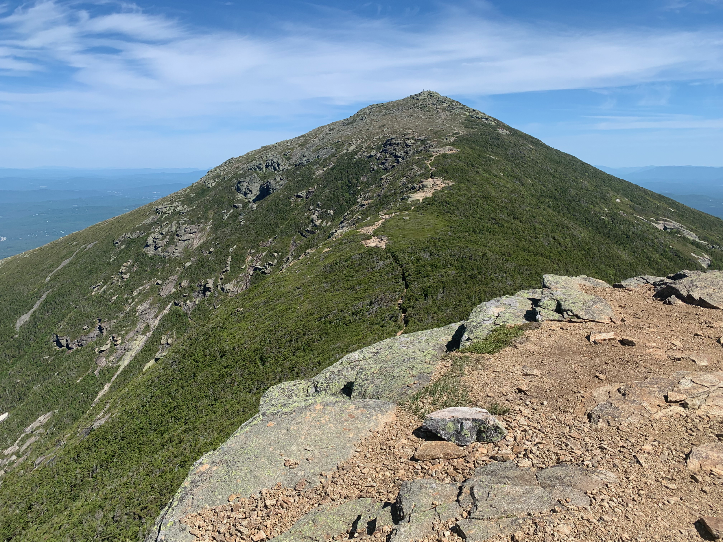
The view when you pop up above treeline on Falling Waters Trail and onto Franconia Ridge.
Once you pop up above treeline on Falling Waters Trail, you’ll be at the summit of Little Haystack. Looking left, you’ll see the Franconia Ridge Trail, which is 1.6 miles long. In this moment, you’ll be in awe of what you’re seeing. The ridge is truly majestic. You’ll get a boost of energy from the excitement of hiking across it and will forget about the three-mile push you just endured.
Although Little Haystack is 4,760 feet, it is not part of the official 4,000-footer list, but Mount Lincoln and Lafayette are, which you’ll be approaching shorty. While moving in joy across this mind-blowing trail, many hikers think that the next big summit they see on the ridge is Mount Lafayette, but it’s not. You’ll have to go over Mount Lincoln and North Lincoln first. Enjoy every second of being up here—it’s a special moment that most people in the world will never have the pleasure of experiencing.
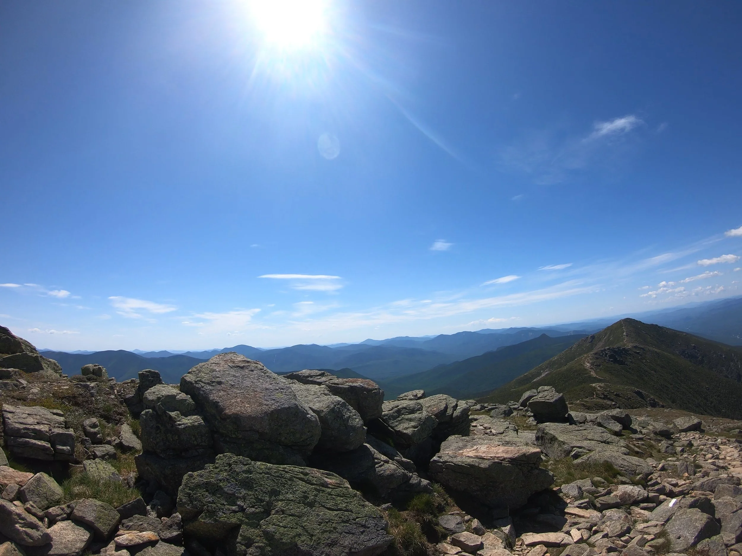
Mount Lafayette Summit
The highest point on the ridge at 5,249 feet.
Once you get to Mount Lafayette at 5,260 feet, it’s all downhill from there. After stopping for your summit sandwich and shots on your camera, make sure to check your map to ensure you go down the right trail. It’s very common for hikers to go right and accidentally start hiking down Garfield Ridge Trail. When going down, stay left on Greenleaf Trail.
Heading to Greenleaf Hut and Eagle Lake

Eagle Lake and the ridge from Greenleaf Hut.
For 1.1 miles, you’ll be heading down the rocky Greenleaf Trail. On a clear day, you’ll be able to see Greenleaf Hut, which is open from May to October. At the hut, you can stop for restrooms, water, and snacks (besides in May, which is self-service only). Don’t stop here for too long though because you’ll still have a few miles left on the hike. While sipping a hot cup or coffee and eating a brownie, take in the view of what you just conquered and Eagle Lake, which is a lake next to the hut. It’s always cool to see a lake high up in elevation.
The Last Stretch: Descending Old Bridle Path

Coming down a steep section on Old Bridle Path.
For 2.9 miles, you’ll be heading down Old Bridle Path. This trail offers several viewpoints which you can stop at for one last look at what you just accomplished. It’s always amazing to see how far you hiked, especially from the perspective that this trail offers. While going down, there are a couple of steep sections with smooth rocks. These rocks are slippery, so proceed with caution. Once you get past this point, the trail is pretty gradual. You’ll eventually connect back to Falling Waters Trail for a 0.2-mile walk back to the Lafayette Place Parking Lot. You completed the hike!