
Hiking the Iconic Knife Edge on Katahdin

Climbing onto The Chimney at the beginning of Knife Edge.
Over 400 million years ago, a mountain was formed by laccolith, which is intrusive rock with a dome shape that forms from magma coming up through the crust of the Earth. Overtime, glaciers molded it into a rugged shape that makes it daunting to look at, yet hard to look away. The Penobscot Indians once inhabited the land and utilized its resources in surrounding regions. They gave it a name that means, “The Greatest Mountain,” and it’s known today as Mount Katahdin, which is the tallest peak in Maine, at 5,269 feet.
Mount Katahdin is in Baxter State Park, which has over 220 miles and 200,000 acres of land. It’s where the Appalachian Trail ends, and it attracts hikers from all over for its jagged hiking trails, thrilling summits, and calming campgrounds. It is truly one of nature’s greatest masterpieces, so it’s no wonder why so many outdoor enthusiasts are drawn to making a trip out there at some point in their lives.
One of the most well-known sections on Mount Katadhin is Knife Edge, which is a 1.1-mile trail with sections as narrow as four feet with 2,000-foot drops on each side. As terrifying as this may sound, it’s an unforgettable experience for those who are mentally and physically prepared. After crossing this rugged trail this past summer with a group of friends, here’s my advice for hiking Mount Katahdin’s Knife Edge.
Planning Your Trip
Unless you’re from the local area, it’s worth booking a campsite for two or three nights in Baxter State Park. No matter which trail you take, hiking Mount Katahdin takes an average of 8 to 12 hours to complete, so you won’t want to be driving to-and-from the park the day of your hike. For those who live close by, you’ll need a day-use parking reservation. Campers can get right into Roaring Brook Campground, which is where hikers planning to hike Mount Katahdin park. I strongly suggest getting there by 6 a.m. in order to secure a parking spot. Visit the Baxter State Park reservations page for more information. You should reserve a spot or campsite months in advance to ensure there’s availability.

Katahdin Stream Campground
Relaxing in front of a fire this past August with friends before the sun went down.
When I entered the park this past August, I pulled up to a quiet campground next to a stream, where my friends were eagerly waiting for me. We stayed at Katahdin Stream Campground, which is a lot quieter than the more popular one: Roaring Brook Campground. Many hikers prefer to stay here since it’s right next to Mount Katahdin’s trailhead. We were about 45 minutes away from the trailhead, but the tranquil water, cozy lean-tos, and pretty flowers at Katahdin Stream made it all worth it.

The dark night sky at Nesowadnehunk Field on a chilly September night.
When I went to Baxter Start Park a couple of years prior, I stayed at Nesowadnehunk Field, which is the northernmost, most remote campground in the park. If you’re looking for a true wilderness experience, then I suggest staying here, but it’s very far from Roaring Brook Campground, so you’ll have to wake up extra early if you plan on hiking Knife Edge on Katahdin. Otherwise, this campgrounnd is great for fly fishing and it offers the clearest starry sky I’ve ever witnessed in my entire life. Read more about each campground here.
Baxter State Park is only open for camping from May to October, so you should plan your trip here around summertime.
The Hike to Knife Edge on Katahdin
Different Routes
There are several different ways to summit Mount Katahdin. After all, it does have five peaks (Howe Peak, Hamlin Peak, Baxter Peak, South Peak, and Pamola Peak). Those who choose to hike Knife Edge usually aim to summit both Baxter Peak and Hamlin Peak since they both are part of the New England 67. A popular way to conquer Knife Edge and Baxter Peak is via Helon Taylor, Knife Edge, Saddle, and Chimney Pond Trail. To add Hamlin Peak, hikers will continue straight to NW Basin Trail instead of heading right down Saddle Trail. After tagging Hamlin Peak, they can either come back the way they came and go down Saddle Trail or just descend via Hamlin Ridge Trail. As for my friends and I, we ascended Chimney Pond Trail and Dudley Trail instead of Helon Taylor Trail to get to Knife Edge on Saturday, August 12. Here’s how it went.

Chimney Pond Trailhead
You’ll start on Chimney Pond Trail and hike 3.3 miles to Chimney Pond Campground.
Roaring Brook Campground
It was well before 6 a.m. when we pulled up to the Roaring Brook Campground trailhead. We all sluggishly exited the vehicles to gear up in our boots and packs. After a last few sips of caffeine and warm-up stretches, we made our way to the trailhead of Chimney Pond Trail to sign in at the ranger station, which is required. As we made our way uphill gradually, the mix of nerves and exhaustion made it difficult for me to engage in conversation. My mind and body were still waking up from a restless night in my tent.
Chimney Pond Campground
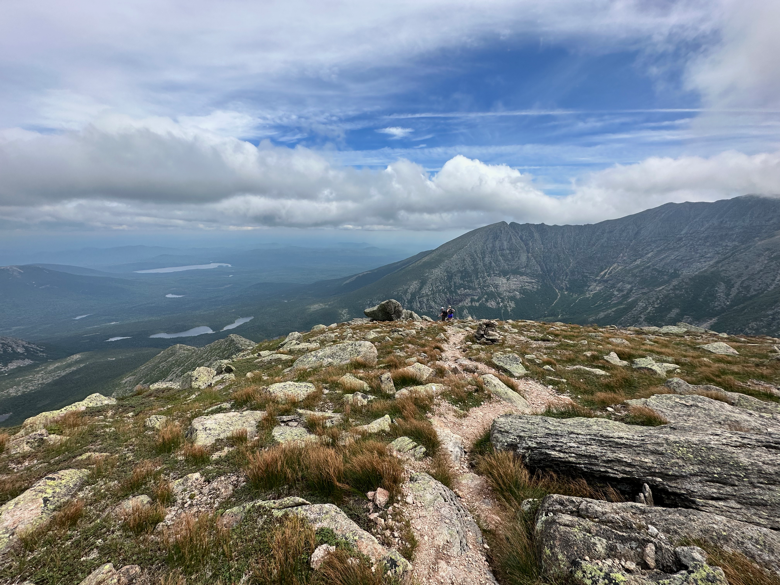
The 3.3-mile trek to Chimney Pond Campground was pleasant. From the serene sounds of Roaring Brook to the beautiful basin ponds, my nerves slowly turned into excitement. I felt fully immersed into my surroundings and grateful to be where I was with my people. From the campground, we could see the iconic Knife Edge in the distance. From afar, it looked like the edge of a sword. It felt as if we were about to go into battle. Even with some fear, we were ready to conquer.

Looking up at Knife edge from Chimney Pond Campground.
Dudley Trail to Pamola Peak
Dudley Trail is when this hike starts to become really difficult. The trail is 1.4 miles of rugged roots, technical rocks, and sudden winds. By the time you break treeline, it feels like it takes forever to get to Pamola Peak. Be mentally prepared for this trail and make sure you are fueling and hydrating properly. You’ll still have Knife Edge to do, which you need energy for. After a few rough sections on Dudley Trail, we finally popped up on Pamola Peak. The view of Knife Edge from this angle is absolutely breathtaking.

Pamola Peak
Right before crossing over Knife Edge, which you can see in the background.
Crossing Over Knife Edge
This is it—you’re about to cross over one of the most iconic trails in all of New England. Do not stop on Pamola Peak for too long because you still have the technical climb across Knife Edge. It’s an exciting 1.1 miles—do not let fear stop you from conquering this mountain via Knife Edge. The moments that build the most character are the ones you once thought you could never endure, but I promise you can.
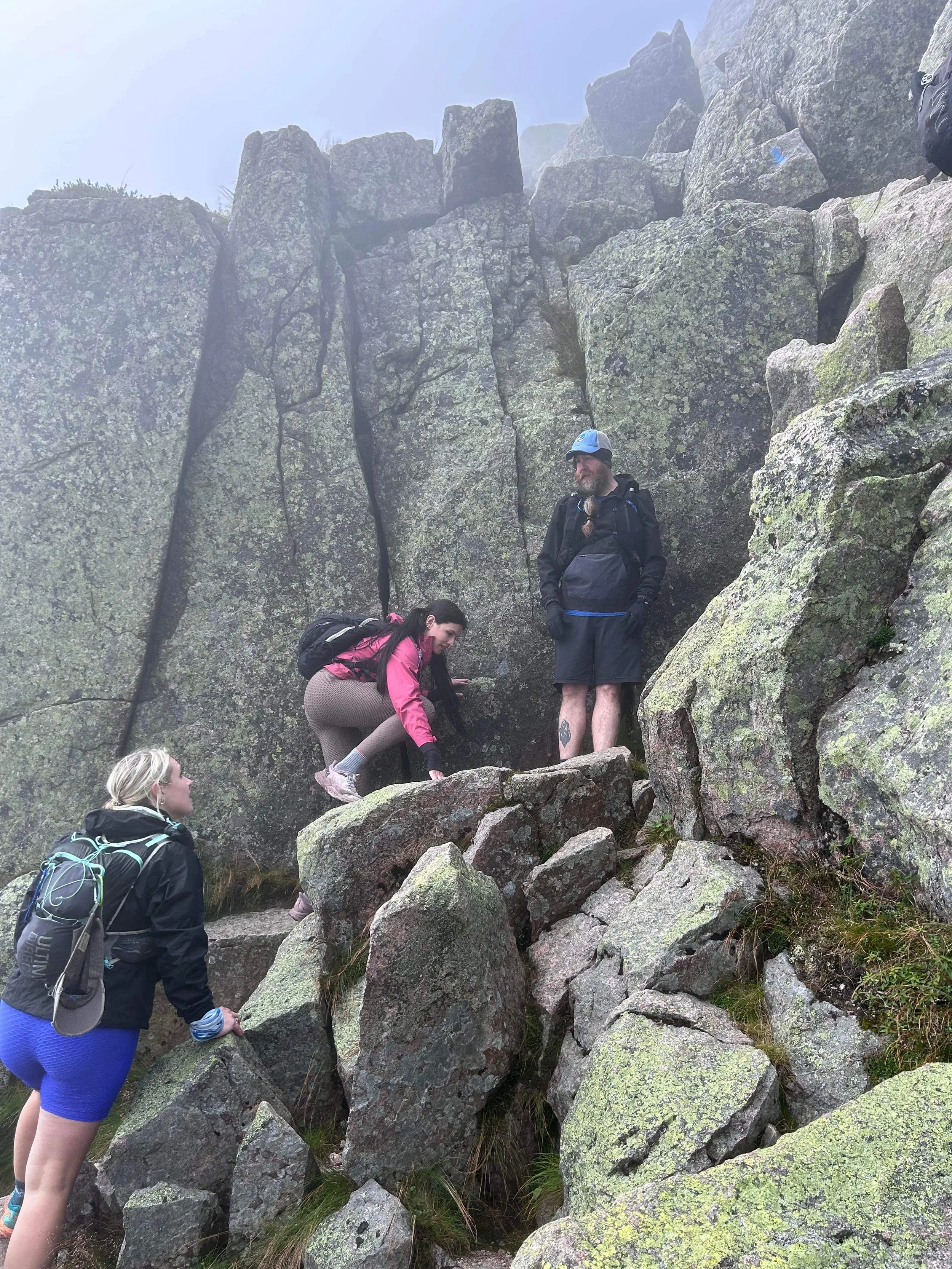
Climbing up The Chimney to the ridge.
Luckily, the first section of Knife Edge is the most technical, so you can get that done first. This part is known as The Chimney. As soon as you exit Pamola Peak, you’ll drop down in almost-vertical elevation, which requires all fours and some words of encouragement from your hiking buddies. The Chimney then climbs directly back up to Chimney Peak. As long as you are cautious with your footing and take your time, you’ll do great. From Chimney Peak, you’ll finally be able to see the sharp and narrow part of the trail that you’ve anticipated up until this point.
Some sections of Knife Edge are narrower than others, but it overall isn’t as daunting as people make it seem—assuming you picked a day with good conditions and weather. I’m not saying it isn’t scary in some sections, but the thrill and rush of freedom you feel when you’re on the edge of the world offers a feeling of joy so strong that it overpowers any reluctance or fear. There’s one section where you hug a rock to the left because there’s a drop on the right side, but there’s a bypass you can take if you aren’t up for it.

Heading to Baxter Peak via Knife Edge.
Baxter Peak to Hamlin Peak
Give yourself a pat on the back—you made it over Knife Edge! Baxter Peak is a special spot. It’s not only the true summit on Mount Katahdin, it’s also where Appalachian Trail hikers finish their journey. If you’re lucky, you may see a few—it’s beautiful and emotional to witness.
From here, you can simply descend Saddle Trail back to the trailhead or push onward to Hamlin Peak. We decided to tag this peak since it’s part of the New England 67 and went down Hamlin Ridge, which I advise you don’t do. It’s better to come back down NW Basin Trail and descend Saddle Trail. Hamlin Ridge is rough, especially after such a long and exhausting day. Overall, I recommend doing this hike via the Dudley, Knife Edge, and Saddle Trail Loop or via Helon Taylor Trail instead of Dudley.
Hamlin Ridge
Descending from Hamlin Peak at the end of the day.
If there’s one thing I learned on this adventure, it’s that everyone experiences Knife Edge differently. Some find themselves less nervous than they anticipated, and vice versa. To me, it feels like complete magic up there, but one of my friends said she’d never do it again. It’s important to know your limits, but to not avoid it out of fear or lack of motivation. You know what they say, the best views always come after the hardest climb.